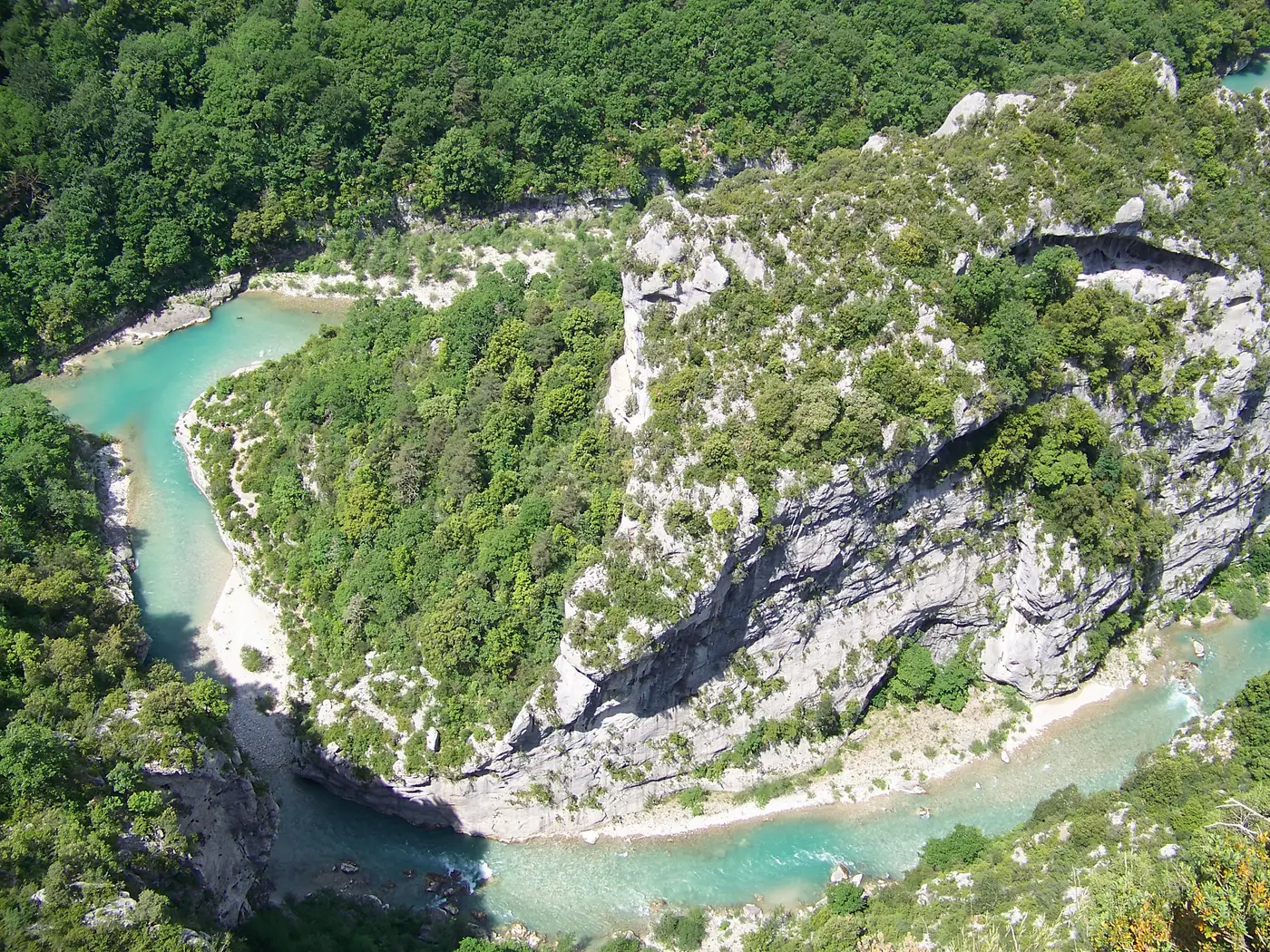
Left bank of the canyon
Corniche Sublime
Wilder and less well known than the Route des Crêtes, the Corniche Sublime (D71) runs along the left bank of the Grand Canyon of the Verdon, from Aiguines to the Pont de l’Artuby, at the gates of Trigance. Here is the route, its viewpoints, the state of the road today and where to park.
- Route
- Aiguines → Col d’Illoire → Vaumale cirque → Falaise des Cavaliers → Fayet tunnels → Balcons de la Mescla → Pont de l’Artuby
- Distance
- About 21 km from Aiguines to the Pont de l’Artuby (tourist office)
- Duration
- About 1 hour 30 minutes of driving, excluding stops at viewpoints
- Direction of travel
- No direction imposed or recommended (unlike the Route des Crêtes)
- Motorhome
- Allowed — 4.30 m high and 12 m long at most; narrow, winding road
State of the road today
The full state of the Verdon today →
The route, point by point
Aiguines is the starting point of the Corniche Sublime on the west side, on the shore of Lake Sainte-Croix: the tourist office counts about 21 km from the heart of the village to the Pont de l’Artuby.
Col d’Illoire is the first viewpoint reached from Aiguines, over Lake Sainte-Croix and the entrance to the canyon — free access, open all year round, parking on site.
About 3 km after the pass, the road runs along the top of the Vaumale cirque (the Col de Vaumale area, mentioned above for the rockfalls): this is where it reaches its highest point, at around 1,200 m altitude according to the IGN.
The Falaise des Bauchers is also one of the road’s viewpoints — less well known than its neighbours, but a clear landmark on the route.
Falaise des Cavaliers is first of all a renowned climbing site (83 routes, from 5b to 8a+), north-facing and ventilated by the gorges — not just a roadside viewpoint. Parking nearby, free access.
About 3 km after the Cavaliers, the road goes through the two Fayet tunnels, cut into the cliff at around 920 m altitude (IGN), before descending towards the Pont de l’Artuby.
A few kilometres further on, the Balcons de la Mescla, at the confluence of the Verdon and the Artuby, are the last viewpoint on the road on the left-bank side. They overlook the confluence by a little over 200 m (IGN altitudes: viewpoint at around 770 m, water at around 555 m).
The Pont de l’Artuby spans the Artuby gorges at about 182 m high according to the bungee-jumping operator that operates there — one of the highest bridges in Europe for this activity. Built between 1937 and 1940 by the engineer Albert Caquot, it now carries the “Remarkable Contemporary Architecture” label.
Bungee jumping at the Pont de l’Artuby →
Beyond the bridge, the D71 leaves the gorges and continues towards Comps-sur-Artuby. Trigance, “built like an eagle’s nest” at 800 m altitude, marks the eastern entrance to the canyon and is reached by the D90 — the Verdon tourist office presents it as the guardian of the gates of the Verdon.
All the viewpoints of the Corniche Sublime →
Parking
A free car park serves the Col d’Illoire and the Falaise des Cavaliers, right next to the viewpoints. There are no official details on the capacity of the car parks at the Balcons de la Mescla or the Pont de l’Artuby: arrive early in summer, as these stops are the busiest on the road.
All the Verdon’s car parks, prices included →
By motorhome
Motorhomes are allowed on the Corniche Sublime, according to the tourist office, which specifies that vehicles must not exceed 4.30 m in height and 12 m in length on the canyon roads — and that the two vaulted tunnels of the Route des Crêtes drop to 3.60 m high at the sides. The road remains narrow, winding and with no imposed direction of travel: take care on the hairpins, especially when passing another vehicle.
The Verdon by motorhome: sizes, areas, roads →
Frequently asked questions
Is the Corniche Sublime open today?
Open again since 20 August 2026 (afternoon), after a closure for rockfalls since 18 August 2026 — the works were completed faster than planned. The status of the Col d’Illoire trail (separate from the road) is not confirmed by this reopening: check locally before setting off on foot.
How long does the Corniche Sublime take to drive?
Allow about 1 hour 30 minutes of driving according to the tourist office, without stops. With breaks at the viewpoints (Col d’Illoire, Falaise des Cavaliers, Balcons de la Mescla, Pont de l’Artuby), half a day is more realistic.
Can you do the Corniche Sublime in a motorhome?
Yes: the tourist office states that motorhomes are allowed and that a visit to the gorges remains accessible to practically all types of vehicle. Vehicles must not, however, exceed 4.30 m in height and 12 m in length, and the two vaulted tunnels of the Route des Crêtes drop to 3.60 m high at the sides. The road remains narrow and winding: drive carefully, especially near the viewpoints where parking spaces are limited.
What is the most impressive viewpoint on the Corniche Sublime?
The Balcons de la Mescla, at the confluence of the Verdon and the Artuby, are the last viewpoint on the road on the left-bank side, a little over 200 m above the confluence. The Pont de l’Artuby, about 182 m high according to the bungee-jumping operator that operates there, is another striking passage on the route.