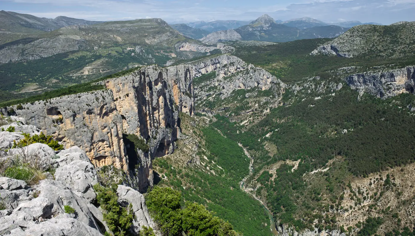
The Route des Crêtes is the go-to panoramic loop on the right bank of the Grand Canyon of the Verdon: about 23 km along the D23 starting from La Palud-sur-Verdon, lined with 14 viewpoints suspended above the void. It’s driven by car (allow 1 h 30 min to 3 h, stops at the viewpoints included, according to the departmental portal), cycled, or ridden by e-bike — it is not a walking trail, but a particularly panoramic road route, a great classic of the gorges. One detail to remember before setting off: one section is one-way, so the loop must be driven clockwise.
Verified on 5 July 2026 with the commune of La Palud-sur-Verdon (official website) and the Alpes-Haute-Provence Tourism portal; length, opening period, construction and one-way section re-verified at the source on 6 October 2026; opening, winter closure of the central section, viewpoints and duration re-read on the Verdon Tourisme website and the departmental portal on 11 October 2026; winter closure, GPX track and elevation gain re-read on 13 October 2026 in the Department’s table of winter closures and on the Verdon Tourisme route listing.
The essentials
| |
|---|
| Distance | 23 km |
| Duration | 1 h 30 min to 3 h by car, stops at the viewpoints included, according to the departmental portal |
| Type | Road loop (car / bike / e-bike) |
| Direction | Clockwise mandatory (one-way section) |
| Open | From late March to late November (commune of La Palud-sur-Verdon, Verdon Tourisme). Only the one-way central section closes in winter, from the last Friday in November to the last Friday in March according to the Department: closure on Friday 27 November 2026, reopening on Friday 26 March 2027 (dates calculated from this rule); the rest of the road remains accessible all year round (departmental portal) |
| Start / finish | La Palud-sur-Verdon |
| Difficulty | Intermediate by bike |
| Viewpoints | 14 viewpoints over the canyon |
The truth about the numbers
The length of the loop is not consistent from one source to another: two figures coexist, even between official publications. Here’s what we use — and why.
| Data point | Value used | Other value seen | Why we settle it this way |
|---|
| Distance | 23 km | 24 km (Verdon Tourisme · departmental portal · Routard · Découvrir Ensemble) | The commune of La Palud-sur-Verdon, which presents the road on its website, gives 23 km, as does GEO. The Verdon Tourisme tourist office and the departmental portal, on its Route des Crêtes page, give 24 km. The gap is small; we go with the commune’s figure, while flagging the 24 km. |
The route, viewpoint by viewpoint
The classic direction — and the mandatory one on the one-way section — is clockwise starting from La Palud-sur-Verdon. The loop strings together 14 viewpoints overlooking Europe’s Grand Canyon. Among those named by official sources:
- La Carelle, le Pas de la Baou, and Trescaire overlook the L’Escalès cliff, the gorges’ main climbing area: around 200 multi-pitch routes over 4 km of cliff (source: camptocamp).
- La Dent d’Aire — a view over the hilltop village of Rougon. A dedicated walking trail also leads there (the Chemin du Belvédère de la Dent d’Aire, listed on Visorando).
- L’Escalès, Le Tilleul — other viewpoints along the D23.
From the cliffs and above Rougon, you can spot griffon vultures (departmental 04 portal).
The road was built in stages, from 1949 to 1972, according to the commune of La Palud-sur-Verdon: it reached the Chalet de la Maline in 1953, and the loop was closed in 1972, from the Dent d’Aire to La Maline. Verdon Tourisme writes that it was laid out mainly for tourism — so it was designed from the outset as a scenic sightseeing route.
The D23 also suits cycling, with several levels of commitment:
- The classic loop from La Palud-sur-Verdon: intermediate level (Routard).
- By e-bike: a 23 km circuit from La Palud-sur-Verdon (GEO), which can be combined with the left bank — gorges des Guègues, pont de l’Artuby, balcons de la Mescla, tunnels du Fayet.
- The big loop: 68.28 km / 1,600 m of elevation gain / 4 h from Aiguines, rated difficult, which uses the D23 (Visorando variant — see the dedicated sheet
gorges-du-verdon-par-la-route-des-cretes-velo).
What’s still missing
We’d rather state this openly than fill the gaps with guesswork:
- The loop’s elevation gain has no single value: the Verdon Tourisme route listing shows 700 m of elevation gain; the tourist office’s page about the road describes, for cyclists, 500 m of climbing to the Pas de la Baou viewpoint, 700 m of descent to La Maline, then 200 m of climbing; the regional portal Provence-Alpes-Côte d’Azur Tourisme shows 1,099 m of elevation gain for the same route. We do not adopt any of these figures as the reference value.
- The winter closure only concerns the one-way central section. The table of winter closures of the Alpes-de-Haute-Provence Department (inforoute04.fr, order 2023-1754) closes the RD 23, between reference points (PR) 8+800 and 13+500, on the last Friday in November and reopens it on the last Friday in March: this winter, according to this rule, closure on Friday 27 November 2026 and reopening on Friday 26 March 2027. The Verdon Tourisme route listing, which the Department’s tourism portal and the regional portal reproduce, writes that the road is one-way between the Jas d’Aire and La Maline, that this section is closed from the 4th Friday in November to the 4th Friday in March (from the Pas de la Baou viewpoint to the Chalet de la Maline) and that the rest remains accessible all year round; it also shows the period from 22 November to 26 March, although 22 November 2026 is a Sunday. Verdon Tourisme’s page about the road and the commune only write from late March to late November. We follow the Department’s rule. The order itself has not been read, and no notice specific to winter 2026-2027 was found: check inforoute04.fr before travelling around these dates.
- The kilometre markers of the one-way section are not published: the commune places the stretch between the Pas de la Baou and the Chalet de la Maline, without a kilometre point.
- A GPX track of the loop is offered by Verdon Tourisme on its route listing, under “Documentation”. We do not host it here.
These fields will be completed as soon as a reliable source documents them.
Sources
Data cross-checked and verified on 2026-07-05: Alpes-Haute-Provence Tourism portal, commune of La Palud-sur-Verdon (official website), Routard, GEO, Découvrir Ensemble, Visorando, camptocamp. Discrepancies kept and resolved above. No invented data: a missing field is flagged as such.
Update of 2026-09-27: peak-time and vertigo guidance sourced from Verdon Tourisme (verdontourisme.com/route-des-cretes/). The comparison with the Corniche Sublime synthesizes several independent travel guides; no official arbitration exists between the two banks.
Update of 2026-10-06: length, opening period, construction stages and one-way section re-read on the website of the commune of La Palud-sur-Verdon (lapaludsurverdon.fr/route-des-cretes/) and on that of Verdon Tourisme. The commune gives 23 km, not 24: the value used has been corrected.
Update of 2026-10-11: pages of Verdon Tourisme (verdontourisme.com/route-des-cretes/) and of the Alpes-de-Haute-Provence Department’s portal (English page on the Route des Crêtes) re-read. The rule of the 4th Friday in November to the 4th Friday in March appears on the departmental portal, not on Verdon Tourisme’s page about the road: the attribution has been corrected. Added: only the one-way central section closes in winter, duration of 1 h 30 min to 3 h. The departmental portal gives 24 km on that page: it has been removed from the sources for 23 km. The drop height attributed to Trescaire and the former duration, with no re-read source, have been removed.
Update of 2026-10-13: the Department’s table of winter closures (inforoute04.fr, order 2023-1754) and the Verdon Tourisme route listing (verdontourisme.com/informations/equipement/la-route-des-cretes-555260id/) re-read. The closure from 22 November 2026, taken on 11 October from the departmental portal, has been removed: 22 November 2026 is a Sunday, and the Department sets the closure on the last Friday in November, the 27th in 2026. The 4th-Friday rule also appears on the Verdon Tourisme route listing, which the departmental portal and the regional portal reproduce under the tourist office’s name (update of 20 August 2026): they are not independent sources. The same listing gives the duration of 1 h 30 min to 3 h, offers a GPX track and shows an elevation gain: these three points, wrongly reported as missing, have been corrected.