Pont de l’Artuby
The bungee-jumping bridge: 182 m high according to the operator, about 137 m from the deck to the river according to the IGN. For those who would rather see the canyon upside down.
The heart of the Verdon
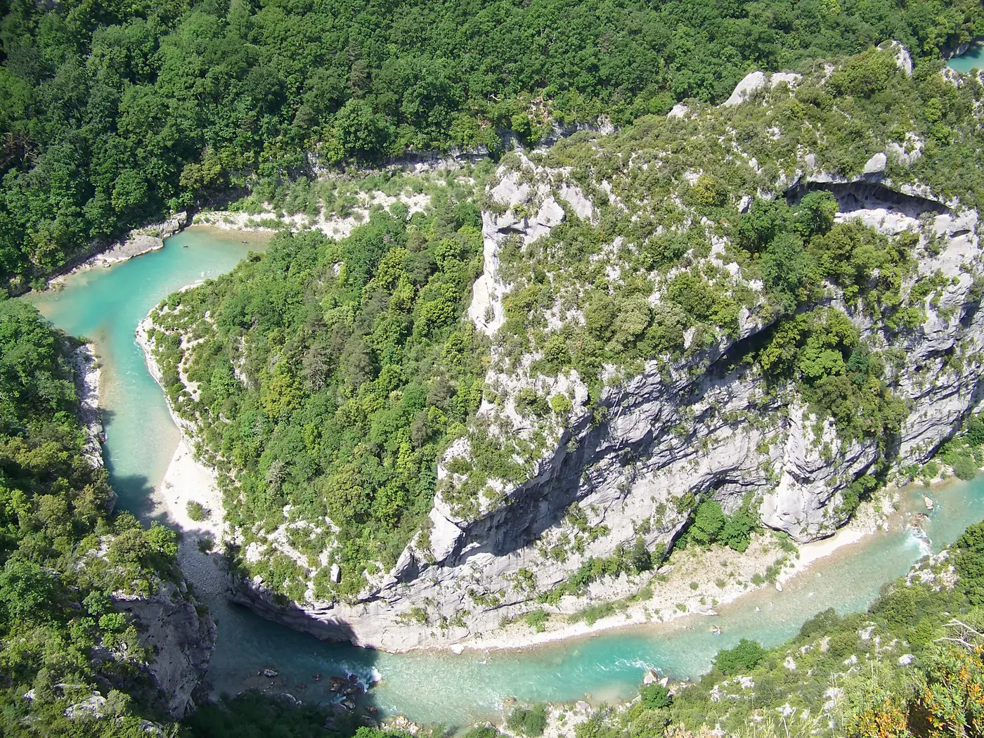
The Verdon Gorge — the Grand Canyon — is, over some 25 km, the turquoise river that has carved into the limestone a canyon reaching about 700 metres deep. From Rougon to the waters of Lake Sainte-Croix, here is the heart of the Verdon: its viewpoints, its two rims, and how to experience it.
The Verdon’s signature viewpoint: a plunging view over the upstream entrance of the canyon and the Couloir Samson, a 10-minute walk from the car park. This is where the Blanc-Martel trail comes out (as of 9 October 2026, via the official detour described below).
Learn more →The panoramic road par excellence: 23 to 24 km according to official sources and around fifteen dizzying belvederes above the void, up to the Dent d’Aire (about 700 m above the river). One section is one-way — follow the signs.
Learn more →The south side: the Col d’Illoire, the Cirque de Vaumale, the Falaise des Cavaliers, tunnels carved into the rock and the Balcons de la Mescla, high above the Verdon–Artuby confluence.
Learn more →The legendary big hike: ~15 km through the heart of the gorge, past tunnels, ladders and turquoise pools, from the Chalet de la Maline to Point Sublime. The Park’s Blanc-Martel shuttle is still running this autumn: Thursday, Friday, Saturday, Sunday and Monday, from September 17 to November 1 2026. As of 9 October 2026, according to the Park’s shuttle website (navette.parcduverdon.fr), a municipal order issued by Rougon on 14 August 2026 closes the end of the trail, following a rockfall, between the exit of the Couloir Samson and Point Sublime. The full hike remains possible via the official detour: RD23A then GR 49, same total duration.
Learn more →Where the canyon flows into the turquoise lake: paddle or take an electric boat up to the first cliffs. The postcard shot of the Verdon.
Learn more →The bungee-jumping bridge: 182 m high according to the operator, about 137 m from the deck to the river according to the IGN. For those who would rather see the canyon upside down.
The one that strings together the most belvederes. Reached via La Palud-sur-Verdon and Rougon: Point Sublime, the Route des Crêtes and its belvederes, and the start of the Blanc-Martel trail at the Chalet de la Maline.
The Blanc-Martel trail on the canyon floor (final section diverted as of 9 October 2026), and all our verified hikes.
By carRoute des Crêtes and Corniche Sublime: the two panoramic roads, bank by bank.
On the waterRafting and canyoning from Castellane, in the heart of the gorge.
By canoePaddle up the first cliffs from the Pont du Galetas.
Season by season: weather, crowds, swimming and what’s open.
Where to stayWhich village to choose depending on what you want to see, from both rims to the lakes.
How long to stayAllow at least two days; our ready-made three-day itinerary.
The mapBelvederes, beaches, villages and services across the Verdon, all geolocated.
The state of the Verdon todayWeather, roads, trails, river flow and car parks — before you set off.
Long left unexplored and feared, the bottom of the gorge was not traversed until 1905, during the expedition of Édouard-Alfred Martel, guided by Isidore Blanc, the schoolteacher of Rougon. It is this crossing that gave the Blanc-Martel trail its name and made the canyon known to the world.
Today, the Verdon is also an ecological success story: the griffon vulture, gone from Provence for over a century, was reintroduced here from 1999 onwards — there is now a well-established breeding colony, which can be seen in flight above the cliffs from Rougon and the Route des Crêtes.
The Verdon Gorge reaches about 700 metres deep at its most vertiginous point (below the Dent d’Aire, on the Route des Crêtes), over a length of around 25 km. It is often nicknamed “Europe’s Grand Canyon” for its scale — even though deeper canyons exist elsewhere in Europe (such as the Tara Canyon in the Balkans).
In three complementary ways: from above, by car on the panoramic roads (the Route des Crêtes on the right bank, the Corniche Sublime on the left) and their belvederes; from the bottom, on foot along the Blanc-Martel trail; and on the water, rafting or canyoning from Castellane, or canoeing from the Pont du Galetas. Allow at least two days to take it all in.
The right bank (north, Alpes-de-Haute-Provence) gives access to Point Sublime and the Route des Crêtes from La Palud-sur-Verdon and Rougon — the one that strings together the most belvederes. The left bank (south, Var) follows the Corniche Sublime from Aiguines to the Pont de l’Artuby, past the Balcons de la Mescla, before heading on to Comps-sur-Artuby. Ideally, explore both (they only meet at either end).
In everyday usage, yes: people say “Gorges du Verdon” when they mean the Grand Canyon. Strictly speaking, “Gorges du Verdon” is the name for the whole, and the “Grand Canyon du Verdon” refers to its deepest section, between Rougon and Lake Sainte-Croix — the one that reaches 700 metres deep, often nicknamed “Europe’s Grand Canyon” for its scale. Further upstream, between Castellane and Rougon, the Verdon cuts through more modest narrows, such as the Clue de Chasteuil; downstream of Lake Sainte-Croix the Basses Gorges open up, towards Quinson and Esparron.
The external sources this page relies on, one click away. We would rather you be able to contradict us than ask you to take our word for it.
The area’s managing authority: regulations by environment (land, aquatic, vertical), bivouacking and camping, fire, drones, advice from the Park rangers.
Official tourist information for the area: sites, services and trip-planning advice.
Association in charge of monitoring and reintroducing the vultures in the Verdon, which initiated the climbing restriction periods for the nesting season.
The reference public body for knowledge of the French subsurface: geological maps, karst and hydrogeology.
All 4 links responded during our last automated check, on 5 October 2026. A broken link is removed, never left in place.