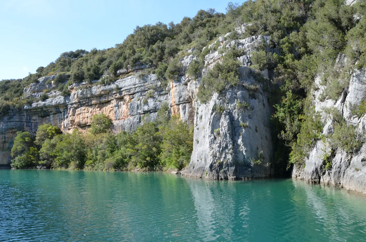
The Gorges de Baudinard form a small turquoise-water canyon, tucked between the Lac de Sainte-Croix and the Basses Gorges du Verdon, on the left bank. It is a less well-known site than the Grand Canyon, often presented as a “secret” — but it is not ONE trail: it is a network of at least six circuits documented around the same canyon, with different starting points and distances. This fact-sheet retains the most complete loop, the one that combines canyon, chapel and lake, and lists the others.
Verified on 20 August 2026 with the Lacs et Gorges du Verdon Tourisme tourist office, Visorando and Wikipedia FR.
The essentials
| Distance | 12.92 km |
| Elevation gain | 471 m of elevation gain |
| Duration | 5h |
| Difficulty | Moderate |
| Type | Loop |
| Start | Town hall car park, Baudinard-sur-Verdon |
| Highlight | Notre-Dame de la Garde chapel (709 m) |
The truth about the numbers (a network, not a trail)
“Gorges de Baudinard” designates the canyon itself, around which several waymarked circuits exist, with starting points spread across two communes. We list them rather than arbitrarily picking just one.
| Variant | Distance | Elevation gain | Duration | Start | Source |
|---|---|---|---|---|---|
| Chapel only | 2.8 km | not given | 1h, round trip | Village car park | Lacs-Gorges-Verdon tourist office |
| Short balcony | 6 to 6.5 km | 222 to 240 m elevation gain | 2h15 to 2h30, loop | D71 | Villa O Verdon, altituderando.com |
| Ravin de Saint-Pierre | 12.67 km | 315 m elevation gain | 4h30, loop | Pont Sylvestre (Montagnac-Montpezat) | Visorando |
| Canyon + chapel + lake (reference retained) | 12.92 km | 471 m elevation gain | 5h, loop | Town hall of Baudinard-sur-Verdon | Visorando |
| Other variants listed | 6.4 to 15 km | depending on the variant | depending on the variant | Saint-Jaume, Vallon des Disputes, Artignosc | Decathlon Outdoor |
What we do not reconcile either: the length of the canyon itself. Wikipedia FR gives 3.2 km in its infobox — the narrow canyon proper. Secondary sources rather cite 13 km, but for the whole stretch between the Lac de Sainte-Croix and Quinson, Lac de Montpezat included. These are not two contradictory measurements of the same object, but two different perimeters.
Do not confuse with the Tour du lac de Sainte-Croix
The GR de Pays Tour du lac de Sainte-Croix (74 km, 4 to 5 days, Moustiers-Sainte-Marie → Bauduen → Aiguines) also crosses the commune of Baudinard-sur-Verdon, and its stage 3 climbs via the same Notre-Dame de la Garde chapel. It is a genuine crossing point between the two routes — but the Tour du lac de Sainte-Croix is a separate long-distance trek, not the subject of this fact-sheet.
The route
From the town hall car park of Baudinard-sur-Verdon, the reference loop descends into the limestone-walled canyon (100 to 150 m high, up to 200 m wide), follows the turquoise water, then climbs back up toward the Notre-Dame de la Garde chapel (709 m) — built at the end of the 16th century (municipal deliberations of 1599, 1608 and 1610), listed as a historic monument on 21 January 1943, restored between 1986 and 1989. A pilgrimage is held there every 15 August. From the chapel, the view stretches over the Lac de Sainte-Croix.
Water activities: the operator Aquattitude, based in Montagnac-Montpezat, offers canoeing and kayaking, paddleboarding and pedal boats in the canyon, mainly in July-August (by reservation the rest of the season, from April to October).
What is still missing
We would rather say so: no dedicated naturalist source (of the PNR type) was found for the fauna and flora specific to the canyon — the descriptive elements (griffon vultures, wild orchids…) come from sources of modest reliability and should be taken as indicative; the elevation gain of the “Saint-Jaume” variant (6.4 km) is not published anywhere; and the effect of the Lac de Sainte-Croix water level on the practicability of the short loops (documented for the Tour du lac, not for these circuits) remains to be checked. These fields will be completed as soon as a reliable source specifies them.
Sources
Data cross-checked and verified on 2026-08-20: Lacs et Gorges du Verdon Tourisme tourist office (lacs-gorges-verdon.fr), Visorando (two fact-sheets: ravin de Saint-Pierre and gorges + chapel), Villa O Verdon, altituderando.com, Decathlon Outdoor, Wikipedia FR (Gorges de Baudinard), CRT Provence-Alpes-Côte d’Azur, sauvegardeartfrancais.fr, aquattitude.com. Discrepancies retained and flagged above. No data invented: a missing field is flagged as such.