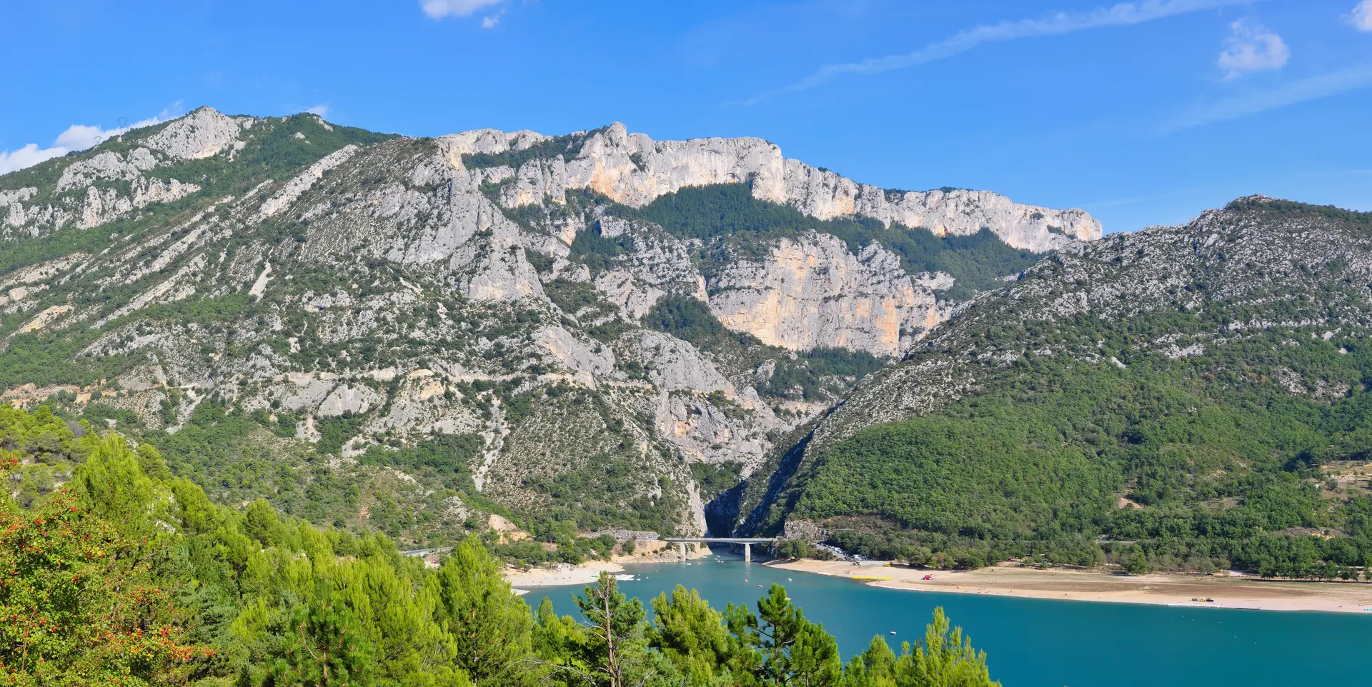
Emblematic place · Aiguines
The Pont du Galetas
It is the image of the Verdon: a bridge spanning emerald water, the Grand Canyon on one side, the immensity of Lake Sainte-Croix on the other. The Pont du Galetas is the point where the river leaves the gorges — the most photographed beach in the Verdon, and the only place from which you can paddle up the canyon. Here is everything you need to know to make the most of it.
- Where
- Commune of Aiguines (Var, 83630), on the D957
- What it is
- The bridge at the exit of the Grand Canyon, on Lake Sainte-Croix
- Dimensions
- 114 m long, about 10 m wide, central span of 57 m
- Swimming
- Pebble beach, supervised in July-August from 11am to 6pm
- Access
- ≈ 7 km / 8 min from Moustiers-Sainte-Marie
- Best time
- Early morning (calm water, free parking)
Where the canyon meets the lake
The Pont du Galetas carries the D957 over the Verdon, exactly at the exit of the Grand Canyon: upstream, the river descends from the gorges; downstream, it opens out onto Lake Sainte-Croix. This great turquoise lake (about 22 km², about 80 m deep at most) is a dam reservoir: it was filled by EDF in 1973, drowning the old valley floor — so the present bridge dates from the creation of the lake, in the 1970s. It is this meeting of cliffs and calm water that makes the Galetas’s postcard view.
The Galetas beach
At the foot of the bridge, on the lake side, lies a fine pebble beach with emerald water, freely accessible all year round. A supervised swimming area is set up there in July and August, from 11am to 6pm (lifeguard post); outside these times and this area, swimming is not supervised, and the water quickly becomes cold at depth. Dogs are allowed on a lead on the beach, but forbidden in the supervised bathing area, and combustion engines are prohibited on the water.
This is the starting point of the finest water outing in the Verdon: you rent a canoe, pedal boat or electric boat at the foot of the bridge and paddle up the entrance of the canyon as far as the yellow buoys (about 2 km). Everything is detailed on our page Canoeing at the Pont du Galetas.
Access & parking
The Galetas is reached by the D957. Allow about 7 km (8 min) from Moustiers-Sainte-Marie and about 20 km (23 min) from the hilltop village of Aiguines (note: the village is much further away than the shore that faces it). As for parking, the official sheets mention a car park without giving its price or capacity: spaces are limited and fill up quickly in the middle of the day in summer. The best habit remains to arrive early in the morning.
- The afternoon wind. The lake is calm in the morning; a thermal wind rises in the afternoon. For calm swimming, canoeing or photography, come early.
- EDF water releases. The danger of a sudden rise in water concerns the river upstream, in the gorges (not the lake beach): take care if you paddle up the canyon or walk in the riverbed.
- The crowds. This is the busiest site in the Verdon in summer. June and September are noticeably quieter.
- Jumping and diving from the bridge. Prohibited, as across the whole of the Sainte-Croix reservoir — a safety rule, not an option.
State of the Verdon (water releases, weather) → Safety in the Verdon →
The Galetas is not the great viewpoints. Here we are at the lower entrance of the canyon, at lake level. The dizzying panoramas — Route des Crêtes, Point Sublime — are upstream, several tens of kilometres by road away. And the canyon you paddle up under the bridge is the Grand Canyon of the Verdon, not to be confused with the Basses Gorges (downstream of the lake, towards Quinson and Esparron).
Frequently asked questions
Where exactly is the Pont du Galetas?
In the commune of Aiguines (Var, 83630), on the D957, at the exit of the Gorges du Verdon, where the Verdon flows into Lake Sainte-Croix. The bridge marks the boundary between the Var (83) and the Alpes-de-Haute-Provence (04), on the Moustiers-Sainte-Marie side. Coordinates: about 43.8016 N, 6.2494 E.
What are the dimensions of the Pont du Galetas?
The bridge is 114 m long, formed of a continuous concrete beam assembled from 3 m box sections. Its height varies from 1.50 m to 3 m depending on the section, and its central span — between its two rectangular piers — extends over 57 m. The deck is 5 m wide, brought to just under 10 m in total by two 2.30 m cantilevers on each side. A concrete structure built in 1970 during the development of Lake Sainte-Croix. Source: General Inventory of Cultural Heritage, Provence-Alpes-Côte d’Azur Region (file IA04002447) — the figures “82 m high, 290 m long” sometimes found elsewhere are confirmed by no official source and are not used here.
Is the Galetas car park paid?
No official price or capacity could be confirmed: the tourist office sheets mention a car park without giving its price. In any case it fills up quickly in July-August — the best approach is to arrive early in the morning.
Can you swim, and is the beach supervised?
Yes: free swimming from a fine pebble beach, with a supervised area in July-August from 11am to 6pm (lifeguard post). Outside this area and these hours, swimming is not supervised; the lake is deep (about 80 m at most) and cold at depth.
Can you paddle up the gorges from the Galetas?
Yes. You can rent a canoe, pedal boat or electric boat at the foot of the bridge (combustion engines prohibited) and pass under the bridge to enter the lower part of the Grand Canyon, as far as the yellow buoys, about 2 km away. See our dedicated page on canoeing at the Pont du Galetas.
What is the best time to come?
Early in the morning: calm water before the afternoon thermal wind, the best light, and car parking still available. To avoid the biggest crowds, June and September are quieter than July-August.
What is the difference between the Galetas and the Verdon’s “Grand Canyon”?
The Galetas is the lower entrance to the canyon, at the lake’s edge. The great viewpoints (Route des Crêtes, Point Sublime) are upstream, several tens of kilometres by road away. Not to be confused either with the Basses Gorges, located downstream of the lake, towards Quinson and Esparron.