Verified, sourced, dated figures
The Verdon in numbers
Depth of the canyon, volume of the lake, age of the rock, sunshine, vulture numbers: the Verdon’s reference figures, grouped by theme. Each one is dated and linked to the page where we verified it in the field, or to the external authority that attests it. A figure without a source is only an opinion — we would rather show you where ours come from.
Why these figures
On the web, several figures circulate for the Verdon — sometimes very different from one another, rarely accompanied by a verifiable source. For the capacity of Lake Sainte-Croix alone, figures of up to 14 billion m³ are sometimes announced elsewhere online: about 18 times the figure we publish here (760 million m³), established on our own pages already verified in the field. Every figure on this page points back to the page where we established it, or to the external source that attests it — click, check, contradict us if we are wrong. And when we have not found a source solid enough to stand behind a figure, we prefer to publish nothing: that was the case for a long time for the sunshine figure, below.
The Grand Canyon
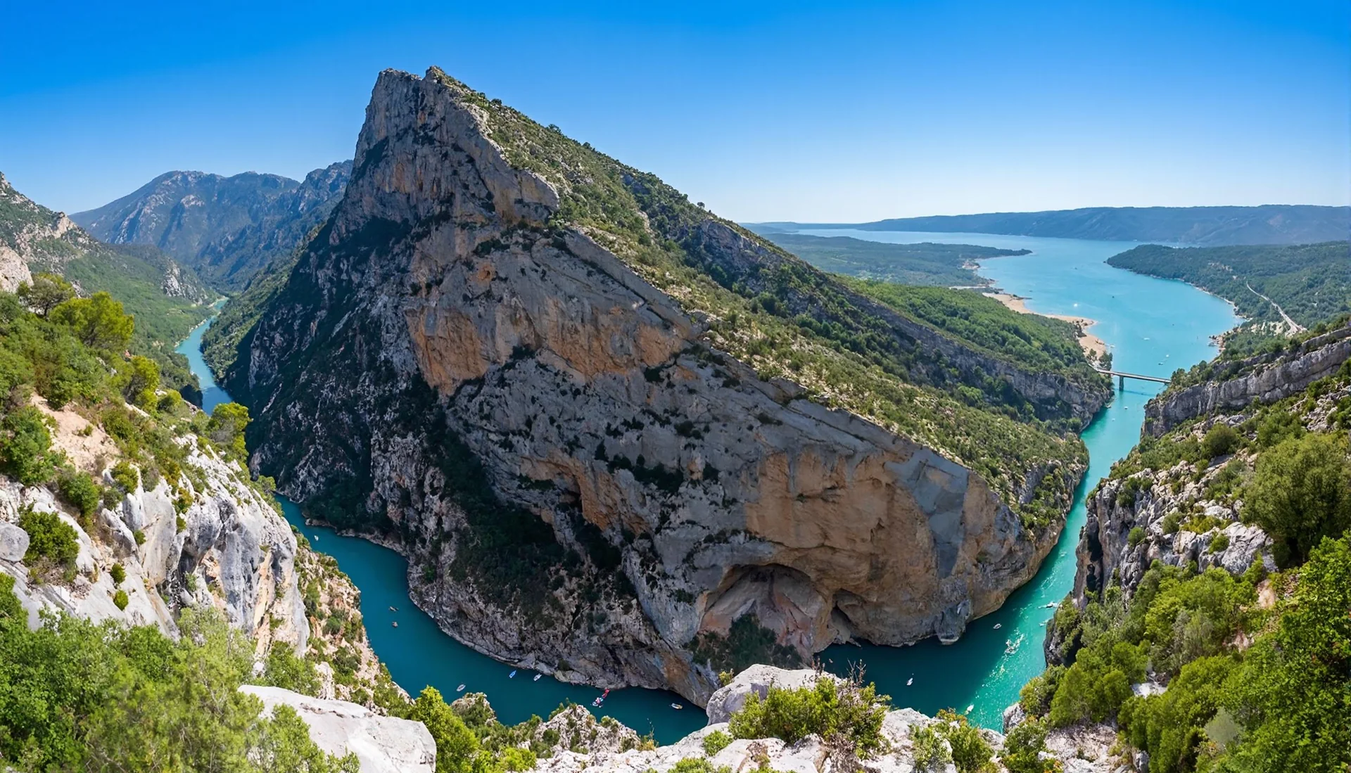
The dimensions of the canyon itself — established and sourced on our dedicated page.
Not to be confused: the Verdon river is 166.5 km long in total, from its source to the confluence with the Durance. The Grand Canyon is only a section of about 25 km.
The detail, verified in the field: The Verdon Gorge →
Lake Sainte-Croix
An artificial reservoir lake, filled by EDF — and the main point of disagreement with the figures circulating elsewhere (see below).
The detail, verified in the field: Lake Sainte-Croix →
Climate: the Verdon’s sun
The only figure we had never published — for lack of a source solid enough to stand behind it. Here is what we found, and where what we know stops.
Measured at Saint-Auban (Alpes-de-Haute-Provence), the official weather station closest to the Verdon to publish sunshine normals — Météo-France normals over the 1991-2020 reference period. No such station exists in Castellane itself: we therefore cite the nearest reference, precisely dated, rather than an unsourced figure attributed directly to the canyon.
Geology: deep time
Two very different ages can be read in a single cliff face: that of the rock, and that of the canyon that cuts into it.
The detail, verified in the field: The geology of the Verdon →
Wildlife: the vultures
Gone from Provence for more than a century, the griffon vulture was reintroduced at Rougon — one of the Verdon’s conservation successes.
The detail, verified in the field: The vultures of the Verdon →
Protected areas: Geological Reserve & Geopark
Europe’s largest open-air geology museum, at the heart of a UNESCO Global Geopark.
The detail, verified in the field: The geology of the Verdon →
Frequently asked questions
What is the exact depth of the Verdon Grand Canyon?
About 700 metres at its most vertiginous point, beneath the Dent d’Aire, on the Route des Crêtes — it is the deepest canyon in France, over a length of about 25 km between Rougon and Lake Sainte-Croix. The detail, with the viewpoints from which to see it, is on our page dedicated to the Verdon Grand Canyon.
Why does Lake Sainte-Croix show different figures depending on the site?
Because few sites cite their source. The figures we publish here — 760 million m³ (760 hm³), about 80 m of maximum depth — come from our own pages, already verified, on the lake and its dam, the depth coming from the official sheet of the Agence de l’Eau Rhône-Méditerranée-Corse (75 m measured, 83 m theoretical). Elsewhere on the web you sometimes find markedly higher figures for the lake’s capacity (up to 14 billion m³ announced, about 18 times more), without any source being cited. We prefer to publish fewer figures, but each one linked to its source.
Is the Verdon really very sunny?
At the nearest reference weather station, Saint-Auban (Alpes-de-Haute-Provence), the official Météo-France normals for the 1991-2020 period record about 2,780 hours of sunshine a year. No station with public sunshine normals exists in Castellane itself: we therefore cite the nearest official station, saying so, rather than attributing an unsourced figure to the canyon.
How long has the Verdon Grand Canyon existed?
The cliff rock — an Upper Jurassic limestone — formed about 150 to 135 million years ago, at the bottom of a tropical coral sea. The canyon itself is much younger: it was carved for the most part during the last two million years (the Quaternary), by the Verdon river swollen with glacial meltwater. Two very different ages for a single cliff face: the detail is on our page dedicated to the geology of the Verdon.
How many vultures live in the Gorges du Verdon today?
More than 300 individuals, including around a hundred breeding pairs — descendants of the reintroduction programme launched at Rougon in 1999, when the species had been absent from Provence for more than a century. All four vulture species of Europe now visit the canyon, a rare fact on this scale. Where and when to watch them: our page dedicated to the vultures of the Verdon.
Where do the figures on this page come from?
From our own pages already verified in the field (canyon, lake, geology, vultures), and from a handful of external authorities cited explicitly below — Météo-France, the BRGM, the Haute-Provence UNESCO Geopark, the LPO PACA. Each figure is dated and linked to its source; when we have not found a figure solid enough to stand behind (as was the case, until now, for sunshine), we prefer to publish nothing rather than invent a precision we do not have. Our full method is explained on the dedicated page.
Check for yourself
The external sources this page relies on, one click away.We would rather you be able to contradict us than ask you to take our word for it.
- UNESCO Géoparc de Haute-Provencegeoparchauteprovence.com
UNESCO Global Geopark covering the area: geological heritage, remarkable sites and science outreach on how the landforms were formed.
- BRGM — national geological surveybrgm.fr
The reference public body for knowledge of the French subsurface: geological maps, karst and hydrogeology.
- LPO Provence-Alpes-Côte d’Azurpaca.lpo.fr
Association in charge of monitoring and reintroducing the vultures in the Verdon, which initiated the climbing restriction periods for the nesting season.
- Météo-France — 1991-2020 climate normals (reproduced by Infoclimat), Saint-Auban stationinfoclimat.fr
Official Météo-France normals for the 1991-2020 reference period at the Saint-Auban station (Alpes-de-Haute-Provence, code 07588): sunshine duration, temperatures and precipitation. Of the 6 Météo-France reference stations in Provence-Alpes-Côte d’Azur, it is the closest to the Verdon to publish sunshine normals — no station of this kind exists in Castellane itself.
4 of these 4 links responded during our last automated check, on 2026-10-02. A broken link is removed, never left in place.